Updated
4/2/23
MT. ROBERTS PARAGLIDING
SITE GUIDE
JUNEAU ALASKA
INTRODUCTION
The Mt. Roberts flying site,
located in Juneau, Alaska, is a USHPA regulated site to ensure the safety of
spectators, pilots and personal property so all visitors may enjoy it. The site is maintained by the members of the
Juneau Eagles Paragliding Club, USHPA Chapter #115.
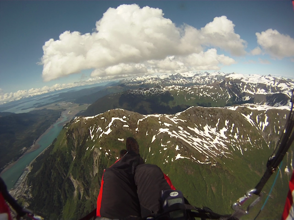
Mt. Roberts is a mountain
thermal site, requiring thermal flying experience to safely fly the site. The
primary launches are small and require strong launch skills to avoid ending up
in the alder thickets below launch.
We are fortunate to have the
Goldbelt Tram to take us most of the way up to launch. It is essential that all pilots follow safe
flying procedures to avoid accidents that could jeopardize our future access to
the tram for paragliding.
SITE PROTOCOLS AND INFORMATION
1.
All pilots must
be USHPA members and have in their possession while flying, their USHPA
membership card or a temporary 30-day USHPA membership card issued by an
authorized individual. Paraglider pilots must have a minimum USHPA Novice (P2)
rating or equivalent foreign rating. Mini-wings pilots must be USHPA Novice
(P2) or above and have a M1or M2 special skill sign off.
2.
A site briefing
by a local pilot is mandatory before flying.
3.
Helmet,
reserve chute, and radio are required on all flights.
4.
Access
to the tram for paragliding requires advance contact with one of the local
paragliding club officers. It is best to
email a minimum of one week before you want to fly the site.
5.
Standard right-of-way
rules apply. Pilot with the ridge on the
right has the right of way. First one in the thermal determines direction.
Pilots must follow FAA rules which include VFR separation from clouds. For more
information, see Aeronautical Information Manual at www.faa.gov.
6.
Flights over
the tram upper terminal, cables, and tram cars shall have a minimum vertical
clearance of 300 feet.
7.
Local
radio frequency is 155.725 MHz
8.
Airspace
& Air Traffic: The airspace in front
of launch is filled with every imaginable type of air traffic, including
commercial 737’s, private jets, tour helicopters, float planes, and transient
fixed wing. As a rated USHPA pilot we operate under Federal Aviation Regulation
Part 103 and must abide by the aircraft traffic rules stated in the
regulations. The airspace at launch is
uncontrolled and “see and avoid” " is the recognized method for avoiding
collision and requires that pilots actively search for potentially conflicting
traffic. Be particularly vigilant when crossing Gastineau Channel towards
Douglas Island and look for inbound (heading NW toward the airport) 737’s and
southbound helicopter traffic close to launch altitude.
9.
Cross
Country Flying: The main XC option from Mt. Roberts is flying toward the
airport and Mendenhall Valley. Because
this route enters the Juneau airport Class D controlled airspace, prior contact
with the airport tower is required.
Contact a local pilot for more information on this procedure.
10. Weather hazards:
Conditions
at Mt. Roberts can be unpredictable and change rapidly. A site briefing by a
local pilot is mandatory. Use extreme
caution when east winds are present or possible. Winds in the landing area can
be much different than launch, both direction and speed, so have a complete
flight plan before launching. Maximum wind speeds at launch are 15 MPH with a
maximum gust factor of +/- 5 MPH in 5 seconds or less. Ideal wind directions
are 220T straight off the face or 300T straight up the spine. OK wind
directions are from 140T clockwise to 320T.
11. Anyone under the influence of alcohol
or other drugs or intoxicants is prohibited from flying. No alcohol or
intoxicating substances may be consumed prior to or while flying.
12. Landing at the CBJ Snow Lot off of
Thane Road next to the water treatment plant is permitted with a signed waiver
available through the Juneau Eagles Paragliding Club.
13.
For Franklin Street dock LZ, if a cruise ship is docked,
the landing zone is not safe for use if the winds are from the northwest
(typical sunny day winds) due to rotor winds generated by the ship, and the
position of the LZ in the lee of the ship.
14.
Local pilots sometimes fly Thunder Mountain near the
Juneau airport. Although Thunder Mt. is
not an USHPA regulated site, the launches are inside the airport Class D
airspace and require prior approval from the airport control tower before
launching. Contact a local club officer
for more information.
LAUNCHES
All launches are rated P2.
Main Launch: The main Mt. Roberts launch is located at about 2180 feet elevation, about a 15-20 minute hike up from the top of the tram, or 1.5 hours hiking up from town. There is room to lay out 2-3 paragliders. Typical sunny day conditions have calm to light winds in the morning, with thermal cycles picking up at noon or later. Since the prevailing wind is from the NW blowing down Gastineau Channel, the wind on launch typically cycles from straight up the hill to 45 degrees cross from the right. It is important for pilots to time their launch with a good cycle coming up the hill. After launch turn left to gain elevation and work your way up the ridge. The usual thermal sources are two small rocky bowls 1/8 mile south of launch and the large avalanche chute about 1/4 mile to the south of launch. Pilots need to use care that they don’t get too low to make it back to the LZ against the headwinds blowing SE down the channel. Glide ratio to LZ: 1.2

South launch: The south launch is about a 5 minute hike farther up the trail. It faces more southerly than the main launch and is better for launching in south winds that would be too cross from the main launch. Glide ratio to LZ: 1.1

2800 Foot launch: The 2800 foot launch faces NW and is the best launch when the wind is blowing NW up the spine of the lower Mt. Roberts launch (90 degree crosswind on the main launch). In these conditions there is usually good ridge lift in the main NW bowl of Mt. Roberts. Glide ratio to LZ: 1.0

LANDING ZONES
All LZs are rated P2.
Rock Dump Beach: The beach at the SE end of the
rock dump (where the fuel tank farm and barge landing/shipping container
facility is located) is the most forgiving LZ and is recommended for visiting
pilots; however it is only usable when the tide level is at 13 feet or below.
Hazards: High
voltage power lines run along the road at the base of the mountain. Avoid doing a final approach over the power
lines. With NW winds pilots need to avoid getting too far downwind of the beach
and ending up in the water. In NW winds
set up your approach with S turns over the beach rather than downwind over the
water. There are tall light poles
surrounding the shipping container storage area. These are a hazard for approaches with
southerly winds.
Snow Storage Lot: The snow lot is adjacent to
the beach—see map—and is the only available LZ when the tide is too high to use
the beach, and there is a cruise ship docked at the Franklin Dock LZ.
Hazards: Same
hazards as the beach LZ. In addition,
the snow lot is surrounded by a chain link fence. Early in the season there can be piles of
snow in the LZ. Later in the season,
there is sometimes equipment parked in the LZ.
With NW winds, there can be turbulence on final approach from the
buildings upwind of the LZ.
Franklin Dock LZ: This LZ can only be used when
a cruise ship is not docked, because the ship can create rotor turbulence as
the winds blow over or around the ship.
Hazards: High
voltage power lines run along the road at the base of the mountain. Avoid doing a final approach over the power
lines. NW winds can create lift blowing up the bank at the edge of the harbor,
causing floating and long landings.
Pilots need to land at the SE end of the LZ. there are tall trees on the road side of the
LZ.
OVERVIEW MAP OF LAUNCHES AND LANDING ZONES

LANDING ZONES MAP

JUNEAU SECTIONAL CHART
Note Class D controlled airspace starting approximately two miles NW of Mt. Roberts

launches and landings. Prior contact with airport control tower required before entering Class D airspace.
Hey Gerry - what's the best way to get in touch with local members for an orientation? I can't find a link to the Juneau Eagles telegram, website, etc.? Thanks! -Kirby
ReplyDelete